  |
More Than Just A Cemetery |   |
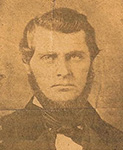
| Z D Blackistone & H A Shanks | E E Shirey & F A Grimm | |
  |
A Family Tribute and Scrapbook This site is an online resource for the ancestry of Bruce Eugene Shirey and Gloria Julene Hughey, and Dr. LeRoy Cecil Mims and Nancy Grace Blackistone. This resource encompasses over 15,000 individuals including direct, collateral, and allied lines. The site also presents over 10,000 scanned images. We would like to thank all who have contributed to this ongoing project. If you have any questions, comments, information, or items to include please Contact The Site Manager. |
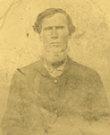  |
| T B Mims & E R Ridgill |
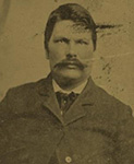
C B Hollowell & C C Dulaney |

All Media
Matches 1 to 50 of 13,437 » Thumbnails Only » Slide Show
| Thumb | Description | Linked to | |
| 1 | Dulaney Cemetery List - The numbers correspond with the numbers on the cemetery map.
Status: Located; Dulaney Cemetery, Graves County, Kentucky. Cemetery on private property. West of Lynnville Kentucky on Highway 94. Turn north on Beech Grove Road. About 1500 feet north of Highway 94. | ||
| 2 | Dulaney Cemetery List 2 - The numbers correspond with the numbers on the cemetery map.
Status: Located; Dulaney Cemetery, Graves County, Kentucky. Cemetery on private property. West of Lynnville Kentucky on Highway 94. Turn north on Beech Grove Road. About 1500 feet north of Highway 94. | ||
| 3 | Dulaney Cemetery List 3 - The numbers correspond with the numbers on the cemetery map.
Status: Located; Dulaney Cemetery, Graves County, Kentucky. Cemetery on private property. West of Lynnville Kentucky on Highway 94. Turn north on Beech Grove Road. About 1500 feet north of Highway 94. | ||
| 4 | Dulaney Cemetery List 4 - The numbers correspond with the numbers on the cemetery map.
Status: Located; Dulaney Cemetery, Graves County, Kentucky. Cemetery on private property. West of Lynnville Kentucky on Highway 94. Turn north on Beech Grove Road. About 1500 feet north of Highway 94. | ||
| 5 | Dulaney Cemetery Map - The numbers correspond with the numbers on the cemetery list.
Status: Located; Dulaney Cemetery, Graves County, Kentucky. Cemetery on private property. West of Lynnville Kentucky on Highway 94. Turn north on Beech Grove Road. About 1500 feet north of Highway 94. | ||
| 6 | Jetton Cemetery List 1 - The numbers correspond with the numbers on the cemetery map. Status: Located; Jetton Cemetery, Graves County, Kentucky. On private property. West on Highway 94, turn south on Howard Protemus Road, turn west on Lynn Swan Road, travel 1-3 miles, on the south side, look for power lines overhead. | ||
| 7 | Jetton Cemetery List 2 - The numbers correspond with the numbers on the cemetery map. Status: Located; Jetton Cemetery, Graves County, Kentucky. On private property. West on Highway 94, turn south on Howard Protemus Road, turn west on Lynn Swan Road, travel 1-3 miles, on the south side, look for power lines overhead. | ||
| 8 | Jetton Cemetery List 3 - The numbers correspond with the numbers on the cemetery map. Status: Located; Jetton Cemetery, Graves County, Kentucky. On private property. West on Highway 94, turn south on Howard Protemus Road, turn west on Lynn Swan Road, travel 1-3 miles, on the south side, look for power lines overhead. | ||
| 9 | Jetton Cemetery Map - The numbers correspond with the numbers on the cemetery list.
Status: Located; Jetton Cemetery, Graves County, Kentucky. On private property. West on Highway 94, turn south on Howard Protemus Road, turn west on Lynn Swan Road, travel 1-3 miles, on the south side, look for power lines overhead. | ||
| 10 | Lassiter #5 Cemetery List 1 - The numbers correspond with the numbers on the cemetery map.
Status: Located; Lassiter #5 Cemetery, Calloway County, Kentucky; Highway 94 west, south on Howard Protemus Road, just south of a small creek. | ||
| 11 | Lassiter #5 Cemetery List 2 - The numbers correspond with the numbers on the cemetery map.
Status: Located; Lassiter #5 Cemetery, Calloway County, Kentucky; Highway 94 west, south on Howard Protemus Road, just south of a small creek. | ||
| 12 | Lassiter #5 Cemetery List 3 - The numbers correspond with the numbers on the cemetery map.
Status: Located; Lassiter #5 Cemetery, Calloway County, Kentucky; Highway 94 west, south on Howard Protemus Road, just south of a small creek. | ||
| 13 | Lassiter #5 Cemetery Map - The numbers correspond with the numbers on the cemetery list.
Status: Located; Lassiter #5 Cemetery, Calloway County, Kentucky; Highway 94 west, south on Howard Protemus Road, just south of a small creek. | ||
| 14 | Albert Hymarsh, Jr. Death Certificate, 1911 Burial at Oak Grove Cemetery, Paducah, Mccracken, Kentucky | ||
| 15 | Asbury Cemetery 1 Status: Located; Asbury Cemetery, Calloway County, Kentucky. West on Highway 121 from Murray. Turn north onto A.S. Berry Road, and south onto Cook Store Road. Just south of A.S. Berry Road. | ||
| 16 | Asbury Cemetery 2 Status: Located; Asbury Cemetery, Calloway County, Kentucky. West on Highway 121 from Murray. Turn north onto A.S. Berry Road, and south onto Cook Store Road. Just south of A.S. Berry Road. | ||
| 17 | Asbury Cemetery 3 Status: Located; Asbury Cemetery, Calloway County, Kentucky. West on Highway 121 from Murray. Turn north onto A.S. Berry Road, and south onto Cook Store Road. Just south of A.S. Berry Road. | ||
| 18 | Asbury Cemetery 4 Status: Located; Asbury Cemetery, Calloway County, Kentucky. West on Highway 121 from Murray. Turn north onto A.S. Berry Road, and south onto Cook Store Road. Just south of A.S. Berry Road. | ||
| 19 | Asbury Cemetery 5 Status: Located; Asbury Cemetery, Calloway County, Kentucky. West on Highway 121 from Murray. Turn north onto A.S. Berry Road, and south onto Cook Store Road. Just south of A.S. Berry Road. | ||
| 20 | Beech Grove Cemetery 1 Status: Located; Beech Grove Cemetery, Graves County, Kentucky. Two miles east of Highway 97 from Boyd's Crossing, which is two miles south of Tri City. In south Graves County. | ||
| 21 | Beech Grove Cemetery 2 Status: Located; Beech Grove Cemetery, Graves County, Kentucky. Two miles east of Highway 97 from Boyd's Crossing, which is two miles south of Tri City. In south Graves County. | ||
| 22 | Beech Grove Cemetery Plaque 1 Status: Located; Beech Grove Cemetery, Graves County, Kentucky. Two miles east of Highway 97 from Boyd's Crossing, which is two miles south of Tri City. In south Graves County. | ||
| 23 | Beech Grove Cemetery Plaque 2 Status: Located; Beech Grove Cemetery, Graves County, Kentucky. Two miles east of Highway 97 from Boyd's Crossing, which is two miles south of Tri City. In south Graves County. | ||
| 24 | Blalock Cemetery Sign 1 Status: Located; Blalock Cemetery, Avoca, Benton, Arkansas. From Rogers, Arkansas, take Highway 62 north towards Avoca, Arkansas. Go past the airport. After the airport, turn right onto Rose Street or County Road 74. From Avoca, go east on County Road 74 over the railroad tracks past the water treatment plant, about 2 miles. At the T in the road turn right, and go past Coose Hollow Road, on the right hand side. You will now be on Posey Mountain Road. After about 2 miles there will be two rock pillars from the remains of a gate. After a mile turn left, then shortly later, turn right onto Arabian Drive. The cemetery will be on the left. The Blalock Cemetery is located on land granted by patent in 1884 to Sarah Harriet Blalock and in the sale of land granted by patent in 1918. The half acre graveyard was excepted from the sale of her heirs, namely Mrs. Safronia A. Taylor, Mrs. S. C. "Callie" Houston, and Mrs. Minerva Ford. | ||
| 25 | Blalock Cemetery Sign 2 Status: Located; Blalock Cemetery, Avoca, Benton, Arkansas. From Rogers, Arkansas, take Highway 62 north towards Avoca, Arkansas. Go past the airport. After the airport, turn right onto Rose Street or County Road 74. From Avoca, go east on County Road 74 over the railroad tracks past the water treatment plant, about 2 miles. At the T in the road turn right, and go past Coose Hollow Road, on the right hand side. You will now be on Posey Mountain Road. After about 2 miles there will be two rock pillars from the remains of a gate. After a mile turn left, then shortly later, turn right onto Arabian Drive. The cemetery will be on the left. The Blalock Cemetery is located on land granted by patent in 1884 to Sarah Harriet Blalock and in the sale of land granted by patent in 1918. The half acre graveyard was excepted from the sale of her heirs, namely Mrs. Safronia A. Taylor, Mrs. S. C. "Callie" Houston, and Mrs. Minerva Ford. | ||
| 26 | Bluff Springs Church and Cemetery in Valeene, Orange, Indiana The cemetery is located on Valeene Pike Road which is off 8400 South County Road 325 in East, Marengo, Orange, Indiana. The church that John Hollowell Sr., Henry Hollowell, and John Hollowell Jr., all donated the land and built the building. John Hollwell Jr. was a preacher here, and John Hollowell Sr. and Henry Hollowell were trusties. All are also buried here. | ||
| 27 | Bluff Springs Church and Cemetery in Valeene, Orange, Indiana Status: Located; The cemetery is located on Valeene Pike Road which is off 8400 South County Road 325 in East, Marengo, Orange, Indiana. The church that John Hollowell Sr., Henry Hollowell, and John Hollowell Jr., all donated the land and built the building. John Hollwell Jr. was a preacher here, and John Hollowell Sr. and Henry Hollowell were trusties. All are also buried here. | ||
| 28 | Bluff Springs Church and Cemetery in Valeene, Orange, Indiana Status: Located; The cemetery is located on Valeene Pike Road which is off 8400 South County Road 325 in East, Marengo, Orange, Indiana. The church that John Hollowell Sr., Henry Hollowell, and John Hollowell Jr., all donated the land and built the building. John Hollwell Jr. was a preacher here, and John Hollowell Sr. and Henry Hollowell were trusties. All are also buried here. | ||
| 29 | Britton Cemetery Status: Located; Britton Cemetery, Oklahoma City, Oklahoma, Oklahoma. The cemetery is located in Oklahoma City on North Western Avenue. | ||
| 30 | Burnett's Chapel Cemetery Sign 1 Status: Located; Burnett's Chapel Cemetery, Graves County, Kentucky. East of Cooksville Kentucky at the intersection of Burnett's Chapel Road and Highway 97. | ||
| 31 | Burnett's Chapel Cemetery Sign 2 Status: Located; Burnett's Chapel Cemetery, Graves County, Kentucky. East of Cooksville Kentucky at the intersection of Burnett's Chapel Road and Highway 97. | ||
| 32 | Cache Cemetery Sign Status: Located; Cache Cemetery, Cache, Comanche, Oklahoma. The cemetery is located east of Cache. Take Highway 62 east, turn south on North West Paint Road, and the cemetery is on the left. | ||
| 33 | Crites Cemetery 1 Status: Located; Crites Cemetery, Bollinger County, Missouri. Southwest of Marble Hill on Highway FF, turn left on Highway PP, turn left on County Road 515, and cemetery is at the end of the road on the right. | ||
| 34 | Crites Cemetery 2 Status: Located; Crites Cemetery, Bollinger County, Missouri. Southwest of Marble Hill on Highway FF, turn left on Highway PP, turn left on County Road 515, and cemetery is at the end of the road on the right. | ||
| 35 | Crites Cemetery 3 Status: Located; Crites Cemetery, Bollinger County, Missouri. Southwest of Marble Hill on Highway FF, turn left on Highway PP, turn left on County Road 515, and cemetery is at the end of the road on the right. | ||
| 36 | Crites Cemetery 4 Status: Located; Crites Cemetery, Bollinger County, Missouri. Southwest of Marble Hill on Highway FF, turn left on Highway PP, turn left on County Road 515, and cemetery is at the end of the road on the right. | ||
| 37 | Crites Cemetery 5 Status: Located; Crites Cemetery, Bollinger County, Missouri. Southwest of Marble Hill on Highway FF, turn left on Highway PP, turn left on County Road 515, and cemetery is at the end of the road on the right. | ||
| 38 | Crites Cemetery 6 Status: Located; Crites Cemetery, Bollinger County, Missouri. Southwest of Marble Hill on Highway FF, turn left on Highway PP, turn left on County Road 515, and cemetery is at the end of the road on the right. | ||
| 39 | Dulaney Cemetery 1 Status: Located; Dulaney Cemetery, Graves County, Kentucky. Cemetery on private property. West of Lynnville Kentucky on Highway 94. Turn north on Beech Grove Road. About 1500 feet north of Highway 94. | ||
| 40 | Dulaney Cemetery 2 Status: Located; Dulaney Cemetery, Graves County, Kentucky. Cemetery on private property. West of Lynnville Kentucky on Highway 94. Turn north on Beech Grove Road. About 1500 feet north of Highway 94. | ||
| 41 | Dulaney Cemetery 3 Status: Located; Dulaney Cemetery, Graves County, Kentucky. Cemetery on private property. West of Lynnville Kentucky on Highway 94. Turn north on Beech Grove Road. About 1500 feet north of Highway 94. | ||
| 42 | Dulaney Cemetery 4 Status: Located; Dulaney Cemetery, Graves County, Kentucky. Cemetery on private property. West of Lynnville Kentucky on Highway 94. Turn north on Beech Grove Road. About 1500 feet north of Highway 94. | ||
| 43 | Dulaney Cemetery 5 Status: Located; Dulaney Cemetery, Graves County, Kentucky. Cemetery on private property. West of Lynnville Kentucky on Highway 94. Turn north on Beech Grove Road. About 1500 feet north of Highway 94. | ||
| 44 | Dulaney Cemetery 6 Status: Located; Dulaney Cemetery, Graves County, Kentucky. Cemetery on private property. West of Lynnville Kentucky on Highway 94. Turn north on Beech Grove Road. About 1500 feet north of Highway 94. | ||
| 45 | Dulaney Cemetery 7 Status: Located; Dulaney Cemetery, Graves County, Kentucky. Cemetery on private property. West of Lynnville Kentucky on Highway 94. Turn north on Beech Grove Road. About 1500 feet north of Highway 94. | ||
| 46 | Enon Cemetery Sign Status: Located; Enon Cemetery, Fulton, Hickman, Kentucky. On the Northeast corner of Highway 307 and Highway 94. | ||
| 47 | Forrester Cemetery 1 Status: Located; Forrester Cemetery, Calloway County, Kentucky. South of Murray Kentucky on Old Salem Church Road. | ||
| 48 | Forrester Cemetery 2 Status: Located; Forrester Cemetery, Calloway County, Kentucky. South of Murray Kentucky on Old Salem Church Road. | ||
| 49 | Forrester Cemetery 3 Status: Located; Forrester Cemetery, Calloway County, Kentucky. South of Murray Kentucky on Old Salem Church Road. | ||
| 50 | Forrester Cemetery 4 Status: Located; Forrester Cemetery, Calloway County, Kentucky. South of Murray Kentucky on Old Salem Church Road. |
NOTICE TO VISITORS
You are welcome to copy information found on this site for personal use, and for sharing with other researchers or genealogical organizations. This information may not be sold or used in a commercial project without expressed permission.
Citations are stated in broad and generalized terms because sources for this site are too extensive to list. In many of the older families, only the direct line has been listed. All images and documents are the property of the site manager, unless otherwise notated. For more complete information or more specific citations, please Contact The Site Manager.
© 2008-2024 - morethanjustacemetery.com
This site powered by The Next Generation of Genealogy Sitebuilding ©, written by Darrin Lythgoe 2001-2024.
Admin